The planning of the project is structured in four work packages and 18 tasks, as follows:
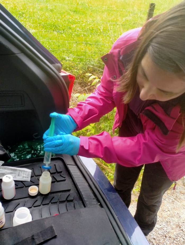
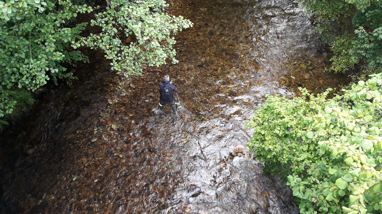
WP1: Characterization of watersheds and potential sources of influence on the sediments The purpose is to describe the characteristics of the selected watersheds, in order to better undertake the following work packages, and to determine the best sampling locations. To reach this objective, the following tasks have been planned: T1. Literature review T2. Characterization of the studied watersheds T3. Inventory of mineralized areas, mining and industrial activities T4. Modeling of the watersheds T5. Study of the use of multispectral images from drone flights for estimation of sediment rates and identification of potential sources zones of contaminants WP2: Sampling and analysis of sediments and definition of background levels This work package includes the important phases of sampling and analysis of the sediments. Water samples will be also taken in order to study the interaction of both media in different parts of the river. The most important deliverable of this work package is the definition of the background levels of the sediments, obtained after a robust statistical analysis of the analytical results. T6. Sediment sampling in different scenarios in the watersheds T7. Physico-chemical characterization of samples T8. Statistical evaluation of analytical data to define geochemical background levels WP3: Assessment of natural/anthropogenic influences on fluvial and coastal sediments After defining the background levels in the previous work package, this WP tries to get the most of the obtained analytical data. First of all, it is intended to find the geochemical genuine characteristics (fingerprint) that define a particular input to the sediments of different nature. This will be useful to characterize the sediments accumulated in the water reservoirs, the interaction between water and sediments, and the historical input to estuarine sediments. Finally, all the information will be available by means of GIS mapping. T9. Definition of geochemical fingerprints T10. Characterization of natural/anthropic influence on solid matter accumulated in reservoirs T11. Study of the interaction between river water and sediments T12. Evidence of contributions from previous sources in the coastal sediments T13. Creation of an open-access GIS mapping including all the gathered information WP4: Opportunities, assessment tools and challenges associated with impacted sediments This WP is designed to describe the applied aspects and solutions derived from the previous WP’s. A methodology for the determination of geochemical background levels in sediments of any watershed will be proposed. In addition, the potential valorization of elements of economic interest present in the sediments will be studied. An important deliverable of this WP is the estimation of the risk associated to polluted sediments and related to this goal is the assessment of the affection to aquatic fauna, as physicochemical methods will be complemented by measuring biological diversity of benthic communities and bioaccumulation in predators. Finally, alternatives for reducing the incorporation of harmful elements to the sediments are assessed. T14. Definition of a standard methodology for the determination of background levels in sediments T15. Valorization of substances of interest T16. Use of specific fauna as indicator of affection to the aquatic ecosystems T17. Estimation of ecosystem risk associated to toxic elements in sediments T18. Study of alternatives of attenuation of input of harmful elements to the sediments 

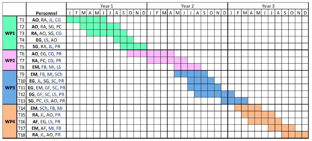
García-Cortés (SG), Pablo Cienfuegos (PC), Alfredo Fernández-Ojanguren (AF), Efrén García-Ordiales
(EG). Work team (in blue): Work team: Jorge Loredo (JL), Sussanne Charlesworth (SCh), Stefano Covelli
(SC), Giorgio Fontolan (GF), Fernando Barrio (FB), Miguel Izquierdo (MI), Lorena Sanz (LS), Carmen
García (CG), Person recruited for the project (PR).